Hunta
Hunting HandbookBlogAboutLog inSign up
Hunta

We digitize hunting: the app for the team in the field and the platform for finding and offering grounds.

Quick Links

  • For hunting teams
  • For landowners
  • About us

Support

  • Support
  • FAQ
  • contact@hunta.no

Hunting Handbook

  • Overview
  • Species
  • Hunting seasons
  • Innlandet
  • Vestland
  • Nordland
© 2026 Hunta AS. All rights reserved.
PrivacyTerms
The map is the whole app

The map is the whole app

August 24, 2026•2 min read
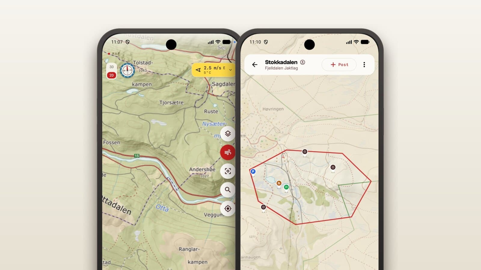
The Hunta app is in Google Play and the App Store, in six languages. The map shows terrain in three dimensions, your team in real time and the wind where you stand, and logging works without coverage.

The map is the whole app

For most apps the map is one screen among many. For us it is the whole app. It is where you see the ground, your team, your stand and the boundary you must not cross.

So that is where we have put the weight.

Terrain in three dimensions

The map shows the hillside as it actually lies, not just as lines on paper. You see the hollow, the ridge and the steep face before you walk in.

Property boundaries come from the Norwegian cadastre, so you know where the ground ends without guessing.
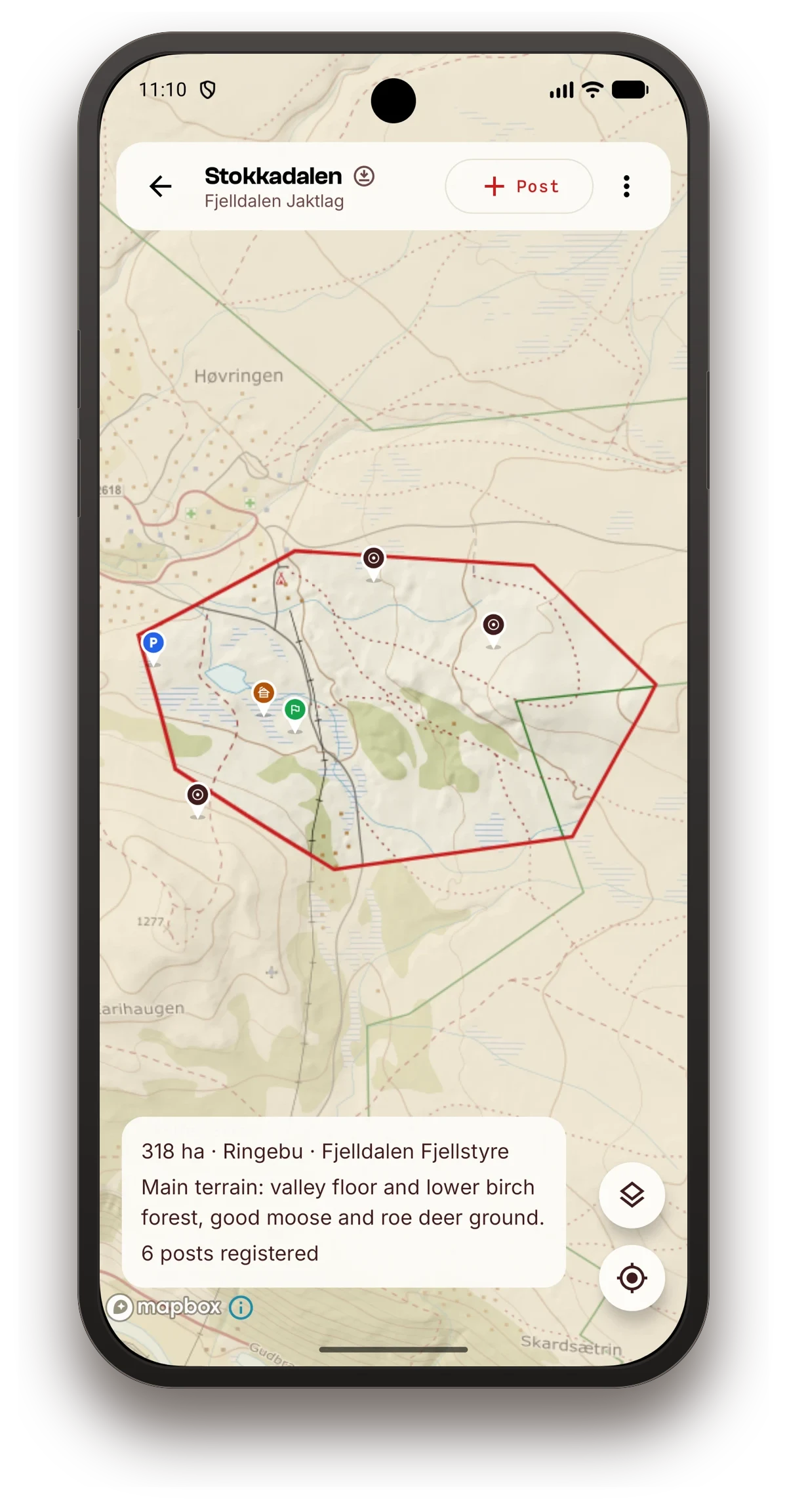
Hunting ground drawn on the map
The ground with its boundaries, drawn in the app.

Your team, as you walk

Start the hunt and the whole team sees each other on the map in real time, with names on each. Your track draws itself as you move.

That means safer stands and better joint hunting, and nobody has to ring around to find out who is where.
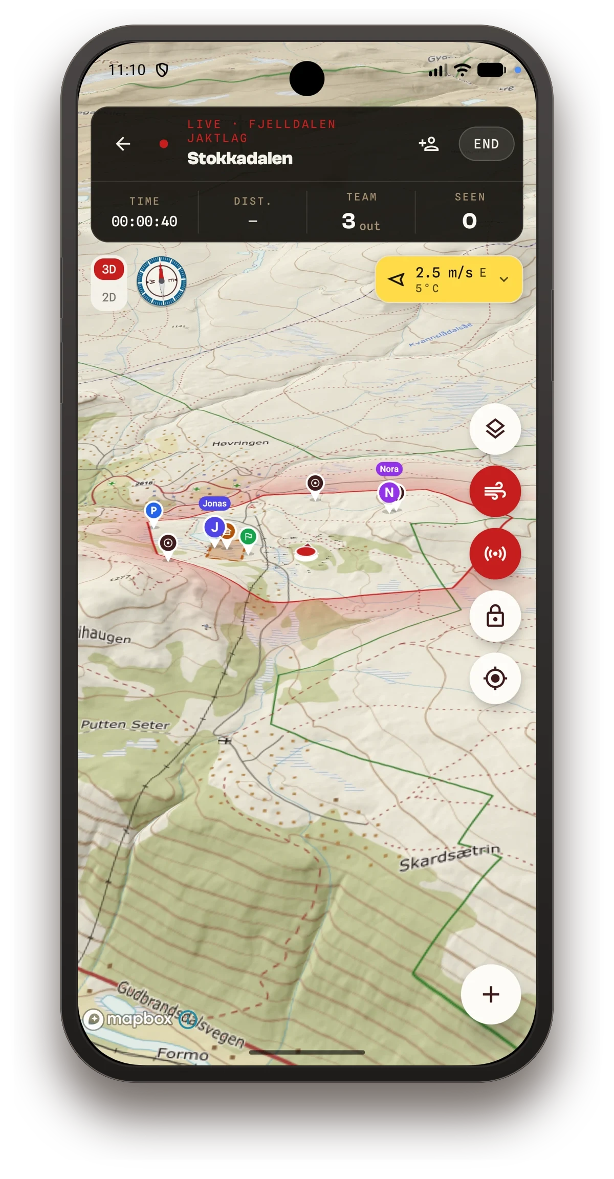
Live hunt with the team on the map
Live hunt: the team on the map while the hunt is on.

The wind where you stand

The forecast is pulled in for your position, not for the nearest town. The wind decides the stand, so it had better be right.

When coverage disappears

The ground people hunt on is usually the same ground where the mobile network gives up. Log a harvest with no signal and it queues on the phone, then sends itself once coverage returns.

Six languages

The app is in Google Play and the App Store, and speaks Norwegian, Swedish, Danish, Finnish, German and English. Borders mean little to hunting, and nor should the tools.

Come and test it

The app is free. We do not charge for seeing your team on the map, logging a harvest or planning the hunt, and we are not going to.

Are you in a hunting team that wants to try it? Download the app, and tell us what is missing.

Hunta
Hunting HandbookBlogAboutLog inSign up
Hunta

We digitize hunting: the app for the team in the field and the platform for finding and offering grounds.

Quick Links

  • For hunting teams
  • For landowners
  • About us

Support

  • Support
  • FAQ
  • contact@hunta.no

Hunting Handbook

  • Overview
  • Species
  • Hunting seasons
  • Innlandet
  • Vestland
  • Nordland
© 2026 Hunta AS. All rights reserved.
PrivacyTerms
The map is the whole app

The map is the whole app

August 24, 2026•2 min read
The Hunta app is in Google Play and the App Store, in six languages. The map shows terrain in three dimensions, your team in real time and the wind where you stand, and logging works without coverage.

The map is the whole app

For most apps the map is one screen among many. For us it is the whole app. It is where you see the ground, your team, your stand and the boundary you must not cross.

So that is where we have put the weight.

Terrain in three dimensions

The map shows the hillside as it actually lies, not just as lines on paper. You see the hollow, the ridge and the steep face before you walk in.

Property boundaries come from the Norwegian cadastre, so you know where the ground ends without guessing.

Hunting ground drawn on the map
The ground with its boundaries, drawn in the app.

Your team, as you walk

Start the hunt and the whole team sees each other on the map in real time, with names on each. Your track draws itself as you move.

That means safer stands and better joint hunting, and nobody has to ring around to find out who is where.

Live hunt with the team on the map
Live hunt: the team on the map while the hunt is on.

The wind where you stand

The forecast is pulled in for your position, not for the nearest town. The wind decides the stand, so it had better be right.

When coverage disappears

The ground people hunt on is usually the same ground where the mobile network gives up. Log a harvest with no signal and it queues on the phone, then sends itself once coverage returns.

Six languages

The app is in Google Play and the App Store, and speaks Norwegian, Swedish, Danish, Finnish, German and English. Borders mean little to hunting, and nor should the tools.

Come and test it

The app is free. We do not charge for seeing your team on the map, logging a harvest or planning the hunt, and we are not going to.

Are you in a hunting team that wants to try it? Download the app, and tell us what is missing.